

Water & Climate
From the ninth to the fifteenth centuries, Angkor was one of the most advanced urban centers in the world. Some estimates suggest that the population numbered close to a million people, making greater Angkor by far the largest city in the world in this period.
In this module, we explore the Khmer relationship with the environment through three topics: Living With Water, The Hydraulic City, and Climate Vulnerability.
Theme One: Living With Water
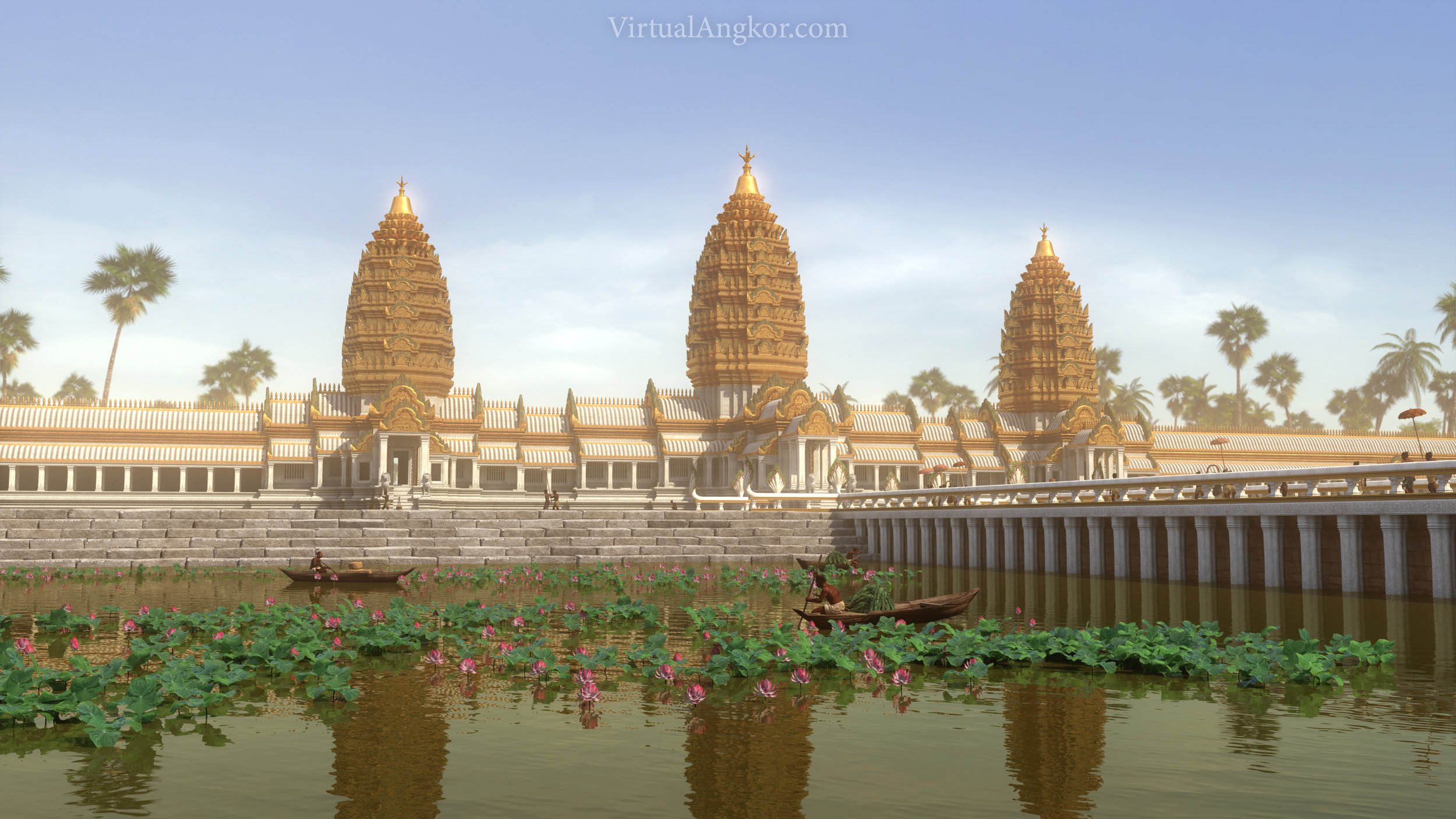
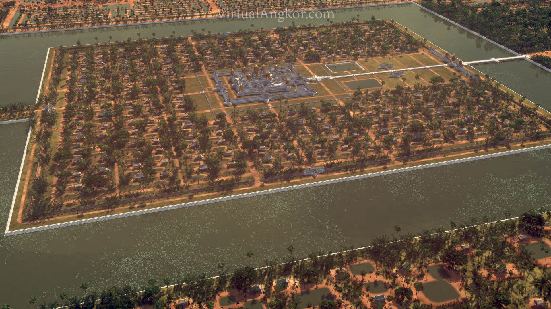
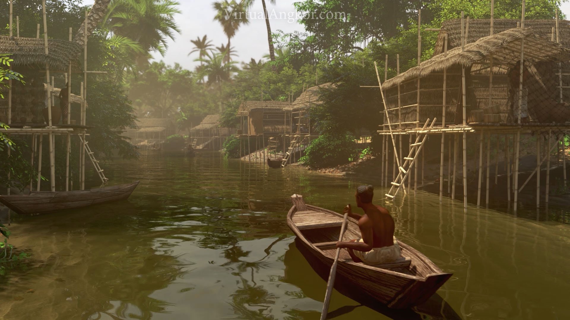
The Khmer people that inhabited Angkor had an intimate and complex relationship with water. As their empire grew, so did its thirst for water. The population of Angkor interacted with water on a day to day basis through a sprawling network that served in part to regulate floods and irrigate agriculture. Damian Evans describes this infrastructure as follows:
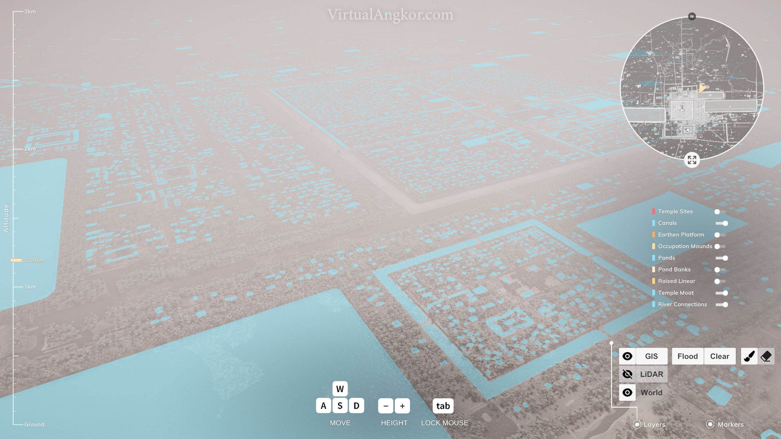
“The network of water management infrastructure that was developed in the heartland of the Khmer Empire during the classical Angkor Period (approximately ninth to fifteenth centuries AD) is one of the signal engineering achievements of the preindustrial world … The broader network consists of three major components: an upstream system of diversions, canals, and dams designed to alter the natural flow of water across the Angkor plain and channel water toward the central monumental zone; a central system of temple moats and vast reservoirs (known locally as baray) designed to store that water (Fig. 2); and a downstream system of canals radiating out from the center designed for the dispersal of stored water (Kummu 2009).”
Damian Evans, Hydraulic Engineering at Angkor, in Encyclopaedia of the History of Science, Technology, and Medicine in Non-Western Cultures (2014)
Take a look at the video and the linked article below and try and answer the following questions:
Readings
Damian Evans, “Hydraulic Engineering at Angkor”, Encyclopaedia of the History of Science, Technology, and Medicine in Non-Western Cultures (2014).
Questions
How was water channeled and controlled in greater Angkor?
Where are the houses? Why do you think they have been built here? What does this tell you about Khmer understandings of their environment?
Does this relationship between water and urban design remind you of any other cities?
What do Uchida and Shimoda set out to find? Why do transportation routes matter and how did Angkor’s system of canals enable the creation of the great monuments of the city?
Examine the images below or proceed directly to the next lesson in the module.
Images

Theme 2: The Hydraulic City
Click to follow the link