

Theme Two: The Hydraulic City
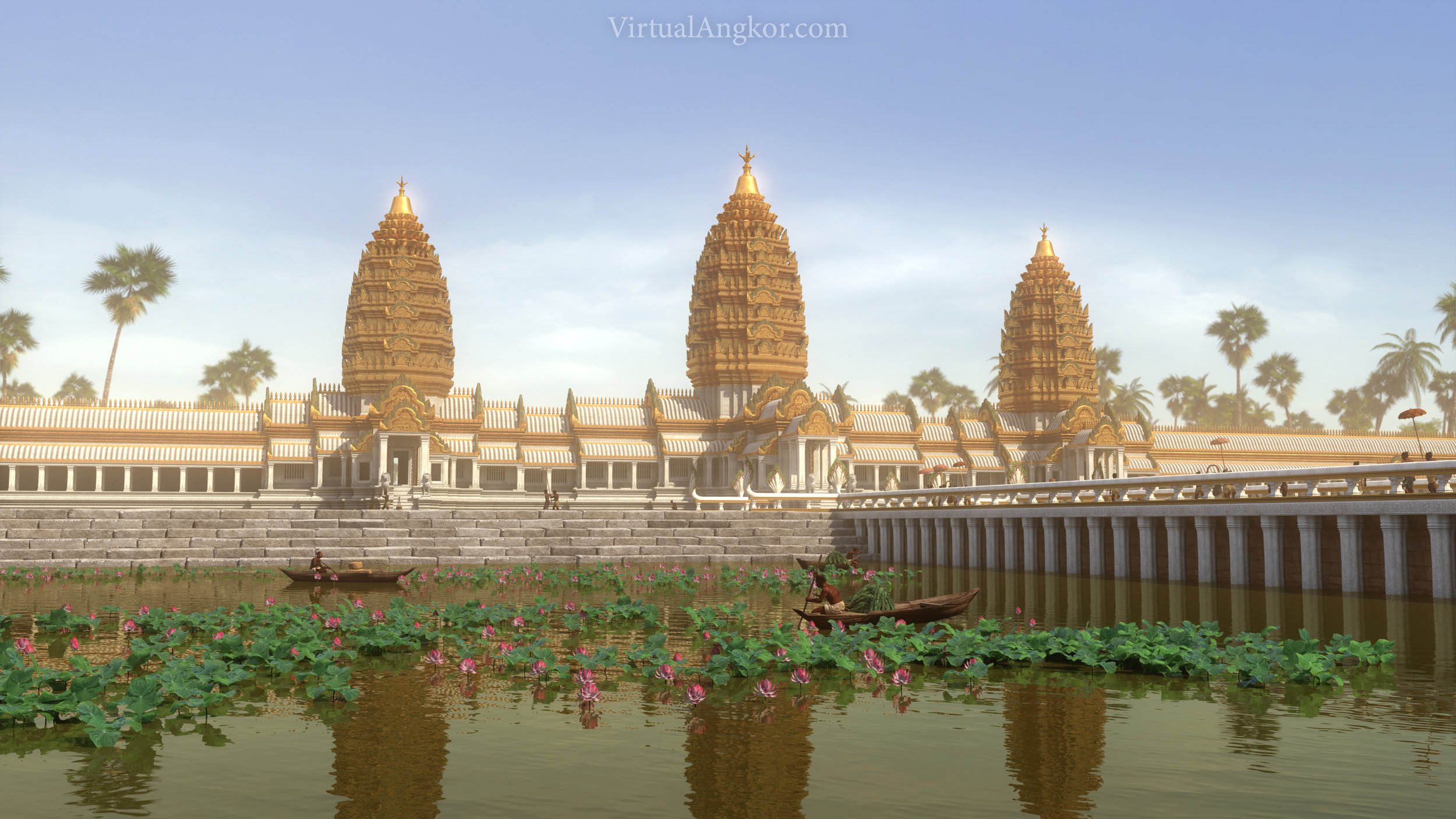
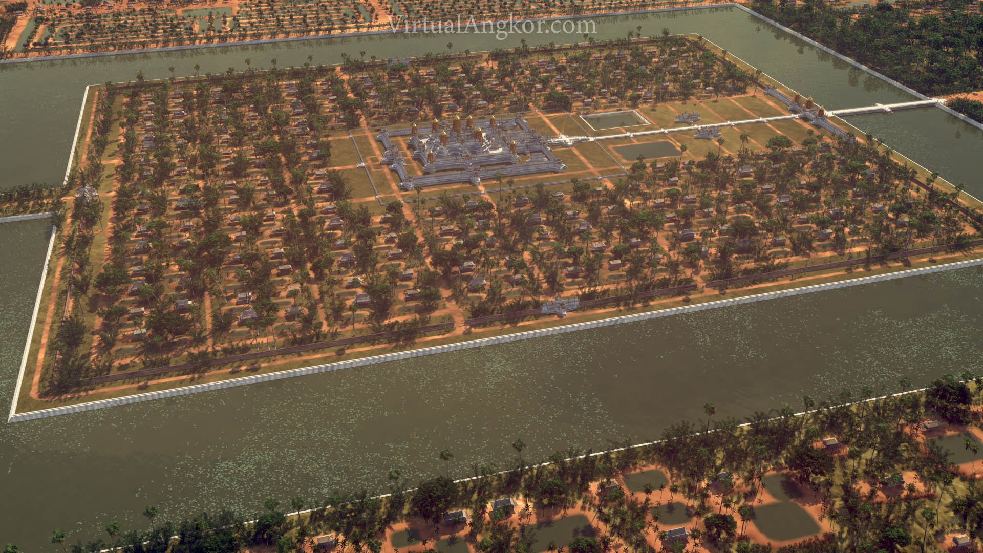
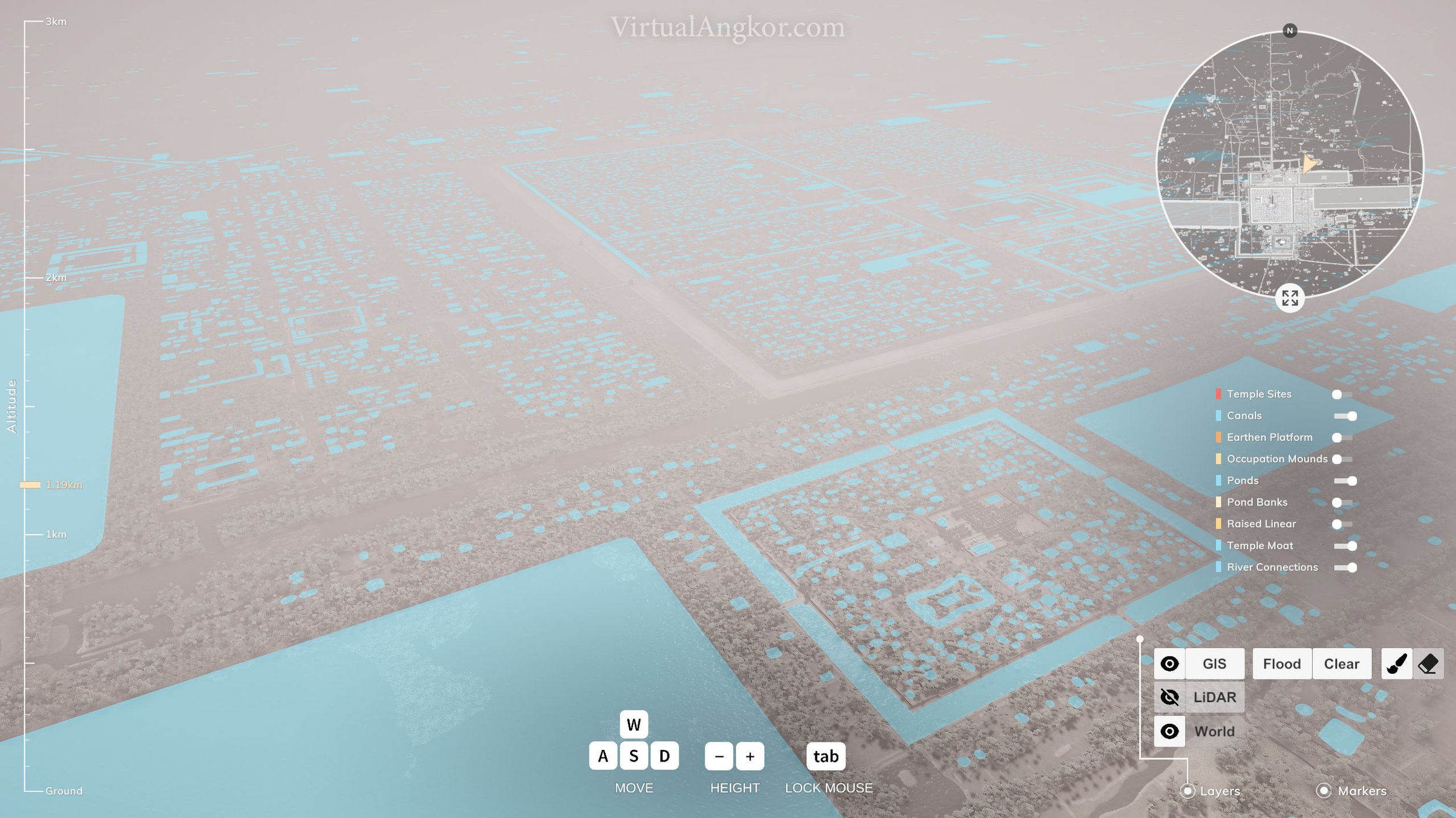
In the 1950s, the French archaeologist Bernard-Philippe Groslier introduced what became known as the “hydraulic city” hypothesis. This argued that Angkor was built on a vast water management system of canals, reservoirs and tanks that provided a constant supply of water for crops. Groslier suggested that the Khmers had established an agricultural system that was capable of sustaining a massive population who in turn served as the labor force that constructed the grand temples of Angkor. Since its publication, a fierce debate has erupted over the validity of the “hydraulic city” hypothesis. Groslier’s critics argued that Angkor’s canals and reservoirs were not part of an elaborate irrigation system but were designed largely for religious purposes. The debate continues but advanced mapping and remote sensing technology, has confirmed at least part of Groslier’s thesis by showing the existence of a sophisticated water management system at Angkor.
We should, however, always remember that the control of water served multiple functions. In a 2016 article, Feneley, Penny and Fletcher note the following:
In the Khmer Empire, water played an essential part in the ‘theatre of state’, as well as in the functioning of the urban settlement and its vast components. The kings of Angkor, from Yaśovarman I onwards, made grand statements of territorial control. Often, these were combined with the establishment of inscriptions and the installation of images of deities on the temple islands created in the baray, known as mebon. The kings' vision was that these statements created certitude (in the minds of the populace) about the king's control over sovereign territories, and established power within central Angkor. Elaborate ceremonies presided over by the kings and their advisers would have played a part in these events. The hydraulic systems, linked with the baray, created not only a water control mechanism but also a spiritual hub between incoming and outgoing water. This gathering together of the powerful forces of nature and the heavens through meritorious public works seems to have been a clear objective of the kings of the Khmer Empire.

Readings
Questions
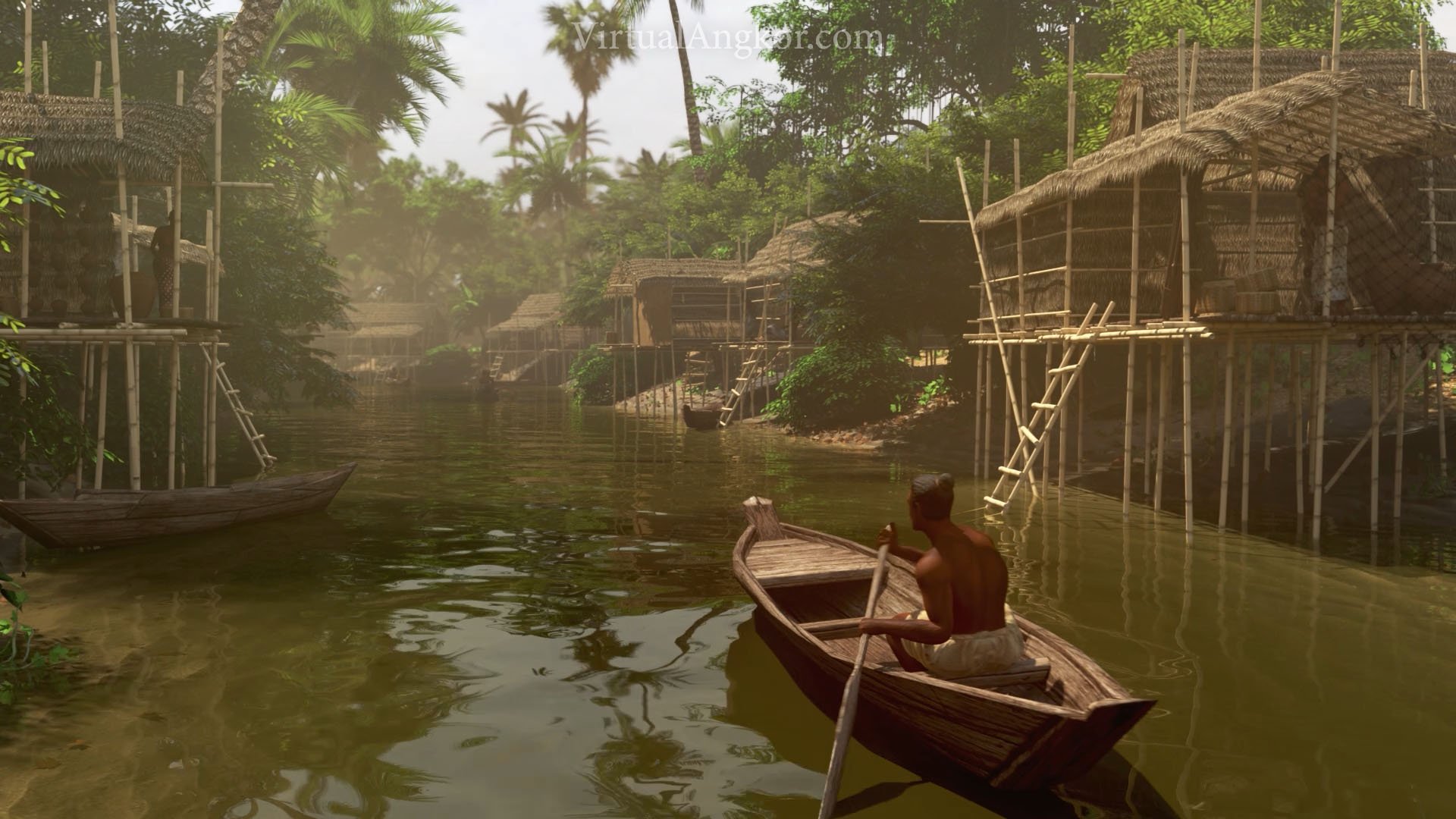
Where do we find water and water features in the city? How does this compare with the city in which you live?
Angkor has been described as a “hydraulic city”. What does this mean? How does this change our understanding of the city?
How do the Khmer kings use water as part of the “theatre of state”?
Look at the distribution of water across the city of Angkor and its immediate surrounds. What does this tell you about how the Khmers interacted with water? What role did water play in the expansion of the Khmer Empire?
Examine the images below or proceed directly to the next lesson in the module.
Images


Theme 3:ClimateVulnerability
Click to follow the link